
Garmin eTrex SE
4.2Editor score
168 hour battery life
Multi-GNSS satellite support
IPX7 water resistance
Navigating the Pacific Crest Trail requires reliable tools to stay safe and on course through remote wilderness areas. A dedicated GPS device ensures you can track your progress, mark waypoints, and find your way back if trails become unclear.
We evaluated ten top-rated handheld GPS units based on satellite accuracy, display quality, battery endurance, and ruggedness for harsh outdoor conditions. Each option offers unique features ranging from basic tracking to advanced satellite messaging capabilities for emergency communication.
Every product listing highlights key specifications, pros, cons, and user ratings to help you choose the right tool for your adventure. Please note that prices and availability change frequently, so verify current details before making your final purchase decision online.
4.2Editor score

4.6Editor score

5.0Editor score
As an Amazon Associate we earn from qualifying purchases.
The following table provides a side-by-side comparison of all ten handheld GPS units selected for this guide, highlighting their core specifications and unique capabilities for Pacific Crest Trail navigation.
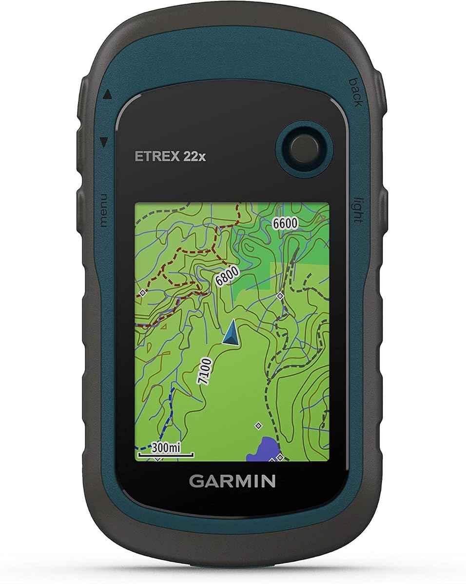




The Garmin eTrex 22x stands out as a dependable tool for hikers seeking straightforward navigation without unnecessary complexity. With a rating of 4.3 stars, users appreciate its rugged build and consistent performance in challenging environments.
We may earn a commission when you buy through this link, at no additional cost to you.
Its 2.2-inch sunlight-readable color display ensures you can see your position clearly even during bright daylight. The device supports GPS and GLONASS systems to improve tracking accuracy in deep canyons or dense forests where signals might drop.
While it lacks modern Bluetooth features, the simplicity of the interface means fewer distractions while on the trail. Battery life remains strong at up to 25 hours, making it suitable for multi-day sections of the Pacific Crest Trail.
This model is ideal for hikers who prioritize reliability and ease of use over advanced smart features. It delivers solid performance for basic waypoint tracking and route finding across varied terrain.
Built to withstand harsh conditions, the unit resists wear and tear from regular backpacking use.
The micro SD card slot allows you to load additional maps for different regions along your route.
We may earn a commission when you buy through this link, at no additional cost to you.
This budget-friendly handheld GPS offers a large 3.2-inch screen that remains readable even under direct sunlight. It supports multiple satellite systems including GPS, GALILEO, and BEIDOU for improved location precision within six feet.
We may earn a commission when you buy through this link, at no additional cost to you.
The rechargeable battery provides up to 36 hours of usage on a full charge, which is excellent for extended trips. Physical buttons ensure you can operate the device easily even with gloves on during cold weather.
While user reviews are mixed compared to major brands, the feature set offers strong value for those needing basic navigation tools. The IP66 water resistance rating helps protect the unit from rain and splashes on the trail.
Consider this option if you want a larger screen and modern charging standards without paying a premium. It serves well for hikers who need reliable tracking for shorter or less remote sections.
Connectivity to four different satellite networks enhances accuracy in difficult terrain like urban canyons.
Standard USB-C charging makes it easy to top up power using modern portable chargers.
We may earn a commission when you buy through this link, at no additional cost to you.
The Garmin GPSMAP 65s delivers superior accuracy through its multi-band technology, making it excellent for steep country and dense forests. With a 4.6 rating, it appeals to serious hikers who demand precise positioning data.
We may earn a commission when you buy through this link, at no additional cost to you.
Its 2.6-inch sunlight-readable color display offers plenty of room to view detailed maps without straining your eyes. The 3-axis compass and barometric altimeter provide essential data for understanding elevation changes and maintaining direction.
While the price is higher than entry-level models, the reliability and feature set justify the investment for long-distance treks. The expandable memory slot lets you store more detailed maps for the entire PCT or other global routes.
This device is highly recommended for thru-hikers or adventurers who need top-tier navigation performance. It balances power, accuracy, and usability in a rugged package built for demanding outdoor conditions.
Multi-band signals reduce errors from atmospheric conditions ensuring you know exactly where you stand.
The barometric altimeter tracks elevation changes which is crucial for monitoring progress on climbs.
We may earn a commission when you buy through this link, at no additional cost to you.
The Garmin eTrex SE is designed for endurance with a battery life of up to 168 hours in standard mode. This makes it an excellent choice for long sections where charging opportunities are scarce along the Pacific Crest Trail.
We may earn a commission when you buy through this link, at no additional cost to you.
It supports multiple global navigation satellite systems to maintain tracking accuracy in challenging environments. The device pairs with the Garmin Explore app for wireless software updates and trip planning convenience.
While the 2.2-inch display is compact, it is easy to read in sunlight and fits comfortably in a hand. The IPX7 rating ensures it can handle rain and splashes without damage during unexpected weather.
Choose this model if battery longevity is your primary concern over advanced mapping features. It offers reliable basic navigation that lasts longer than many competitors using rechargeable batteries.
Pairing with a smartphone allows for active weather forecasts and geocaching live updates.
Field-replaceable AA batteries mean you can keep going by swapping out power sources instantly.
We may earn a commission when you buy through this link, at no additional cost to you.
The S190 Handheld GPS has earned a perfect 5.0 rating from users who appreciate its straightforward functionality. It features a large 3.2-inch sunlight-readable color display that makes viewing maps and waypoints much easier.
We may earn a commission when you buy through this link, at no additional cost to you.
Preloaded with USA Topo maps and a worldwide basemap, it covers essential terrain for hiking the Pacific Crest Trail. The 64 GB internal memory allows for downloading significant additional map data if needed for future trips.
While some users note limitations with map zoom levels, the device offers great value for the price. Its IP64 rating provides protection against splashes and outdoor elements encountered during typical hiking conditions.
This unit is a solid choice for beginners or budget-conscious hikers who need reliable basic navigation. It simplifies tracking routes and ensuring you stay on course with minimal technical complexity.
Massive internal memory means you can store maps for multiple trips on one device.
Connectivity to BeiDou and Galileo satellites improves positioning accuracy in varied environments.
We may earn a commission when you buy through this link, at no additional cost to you.
The Garmin eTrex 32x builds on the reliable foundation of the 22x by adding essential sensors like a 3-axis compass and barometric altimeter. This makes it a step up for hikers who need precise heading and elevation data.
We may earn a commission when you buy through this link, at no additional cost to you.
Its 2.2-inch color display is bright and readable in direct sunlight, though it remains compact. The device supports GPS and GLONASS for better tracking accuracy and offers 25 hours of battery life.
Users appreciate the rugged construction that can handle bumps and drops without issue. The ability to expand storage via a micro SD card allows for adding more detailed map layers for different regions.
This model serves those who want slightly better navigation tools than the base unit without moving to high-end systems. It is a trusted companion for maintaining orientation in dense or featureless terrain.
The 3-axis compass ensures accurate direction even when you are standing still on the trail.
Micro SD support lets you add regional maps without relying on limited internal memory.
We may earn a commission when you buy through this link, at no additional cost to you.
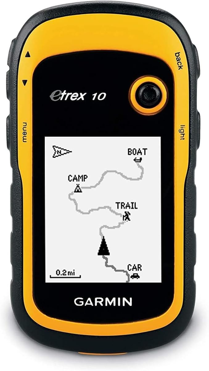
The Garmin eTrex 10 offers a minimalist approach with a monochrome display and preloaded worldwide basemap for universal use. It is lightweight and easy to carry, making it suitable for shorter hikes or backup navigation.
We may earn a commission when you buy through this link, at no additional cost to you.
WAAS enabled GPS with HotFix support ensures fast positioning when you first turn the device on. It is waterproof to IPX7 standards providing reliable protection against rain and accidental drops in water.
While it lacks color mapping and advanced sensors, it delivers exactly what basic hikers need for tracking position. The battery lasts up to 20 hours on two AA batteries which is sufficient for day trips or sections.
Consider this if you prioritize weight savings and simplicity over rich map details. It remains a dependable tool for ensuring you know where you are without unnecessary distractions.
WAAS and HotFix technology reduce wait time before satellite signals are acquired accurately.
IPX7 waterproofing means you can operate it safely even in heavy rain or stream crossings.
We may earn a commission when you buy through this link, at no additional cost to you.
The Garmin GPSMAP 67i adds a critical safety layer with inReach satellite technology for two-way messaging and SOS alerts. This feature allows you to stay in contact with loved ones or emergency services even without cellular service.
We may earn a commission when you buy through this link, at no additional cost to you.
Its 3-inch sunlight-readable color display provides ample room to view maps and messages clearly. The internal rechargeable lithium battery offers up to 185 hours in 10-minute tracking mode for extended trips.
While a subscription is required for the messaging features, the peace of mind is invaluable for remote solo hiking. It combines robust navigation with communication tools in a single rugged device built for the outdoors.
This model is highly recommended for those hiking remote sections of the PCT where communication is a priority. It bridges the gap between navigation and safety monitoring effectively.
Iridium satellite network ensures communication is possible anywhere on the globe.
Triggering an interactive SOS alerts a 24/7 response center to coordinate assistance.
We may earn a commission when you buy through this link, at no additional cost to you.
The Garmin GPSMAP H1i Plus represents the pinnacle of outdoor GPS devices with a hybrid design combining a 3.5-inch touchscreen and physical buttons. This mix allows for intuitive map zooming and quick access to critical functions.
We may earn a commission when you buy through this link, at no additional cost to you.
With inReach Plus technology you can share photos and voice messages to keep your team updated. The device is tested to MIL-STD 810 standards ensuring it survives harsh impacts extreme temperatures and water exposure.
Battery life is exceptional with up to 145 hours in GPS mode and extended endurance in expedition mode. Included accessories like extra batteries and adapters make it ready for long expeditions out of the box.
This device is ideal for adventurers who demand the best connectivity and control available. It is a top-tier investment for safety and navigation in the most demanding environments.
Combining touch and buttons gives flexibility for different navigation tasks and glove usage.
MIL-STD testing guarantees the device can withstand extreme abuse during long hikes.
We may earn a commission when you buy through this link, at no additional cost to you.
The Garmin GPSMAP 66i offers a proven combination of high accuracy GPS and satellite communication capabilities. Its 3-inch color display provides clear visibility for maps and weather data even in bright sunlight.
We may earn a commission when you buy through this link, at no additional cost to you.
You can trigger an interactive SOS and communicate via text messages over the global Iridium satellite network. Battery life is strong with up to 185 hours in expedition mode allowing for multi-week coverage.
Choosing a renewed model allows you to access these premium features at a lower cost point. It ensures you stay safe with reliable navigation and emergency contacts without carrying a separate phone.
This is a great option for those wanting safety features without paying full retail price for new units. It maintains the trusted quality of Garmin's high-end series for serious trail users.
Reliable messaging even in remote wilderness ensures you are never truly out of touch.
Expedition mode optimizes tracking to maximize battery life over long durations.
We may earn a commission when you buy through this link, at no additional cost to you.
Selecting the right GPS requires balancing accuracy battery life and specific features based on your hiking needs.
Look for devices that support multiple satellite systems like GPS GLONASS Galileo or BeiDou. More systems mean better accuracy in difficult terrain like dense forests or canyons.
Multi-system support ensures you maintain tracking where single systems might lose signal.
Choose a unit with battery life that matches your trip duration. Models using AA batteries allow for easy swaps while rechargeable units offer convenience but limited range without charging.
Plan for at least 40 hours of battery life for multi-day hiking without recharge access.
A sunlight-readable color display is essential for viewing maps clearly in bright outdoor conditions. Larger screens help reduce eye strain during long navigation sessions.
Ensure the display is bright enough to read directly under the sun without glare.
The device should be rated for water resistance like IPX7 or IP66 to handle rain and accidental splashes. This protection ensures reliability during sudden storms.
Waterproofing is vital for safety and longevity in wet outdoor environments.
Check if the device includes preloaded TopoActive or detailed trail maps. Having routes already available saves time and ensures navigation is ready out of the box.
Expandable memory allows you to download specific maps for the PCT if needed.
Modern GPS devices may offer Bluetooth or Wi-Fi to sync with apps for planning and updates. This connectivity helps keep your maps current without a computer.
Wireless updates make maintaining device software simple while you are in the field.
Consider models with satellite messaging or SOS capabilities if you hike alone or in remote areas. These features can connect you to rescue services when cell service is unavailable.
Safety tools like interactive SOS provide peace of mind during solo adventures.
A rugged build rated for MIL-STD standards ensures the unit can survive drops and extreme temperatures. Physical buttons are also useful when gloves or rain make touchscreens difficult.
Prioritize physical controls and sturdy housing for reliable outdoor operation.
Start by charging the battery or installing fresh AA batteries before your trip. Ensure the device has preloaded maps for your planned hiking region so you can navigate immediately.
Practice turning on the device and acquiring satellite signals in an open area before heading into the wilderness. Familiarize yourself with setting waypoints and tracking your route to avoid confusion on the trail.
After each trip clean the display with a soft cloth and check for any physical damage. Store the GPS in a dry protective case to prevent moisture or debris from affecting performance.
Yes satellite communication features like messaging and SOS require an active subscription plan. The subscription grants access to the satellite network that sends your emergency signals regardless of cellular coverage.
Battery life varies by model ranging from 20 to over 100 hours depending on usage. Using expedition mode with longer tracking intervals can extend life significantly for multi-day sections.
Most handheld GPS units work fully offline using stored maps and satellite signals. Internet is only needed for initial setup or if you want to sync real-time weather via Bluetooth.
AA batteries offer easier replacement on long trips while rechargeable units are lighter and more convenient. Choose based on whether you prefer swapping power sources or charging daily via USB.
Many models have IPX7 or higher ratings allowing them to survive immersion or heavy rain. Always check the specific rating before purchase to ensure it meets your weather conditions.
Most units allow updates via Wi-Fi or a USB connection to a computer. Some models support wireless updates when paired with a smartphone for easy map refreshing.
We reviewed ten top handheld GPS units ranging from budget-friendly trackers to premium safety communicators. The Garmin eTrex SE offers the best value while the GPSMAP H1i Plus stands out for connectivity.
Prioritize battery life and water resistance to ensure your device performs throughout the entire hike. Multi-band technology and satellite support will keep you accurately located even in dense forests.
Prices and availability may fluctuate so always check current listings before purchasing. Select the model that best matches your trail experience and safety needs for a successful PCT adventure.